

Why is there a giant hole in the middle of the forest?
Let me tell you something before we start: so far, no scientific study has explained specifically how Hoyo Cimarrón formed. There is, however, information on the geology of the region and on similar formations elsewhere in the world. With those pieces we can put together a fairly solid explanation of how it may have formed, and that is what we share here.
First, what is Hoyo Cimarrón?
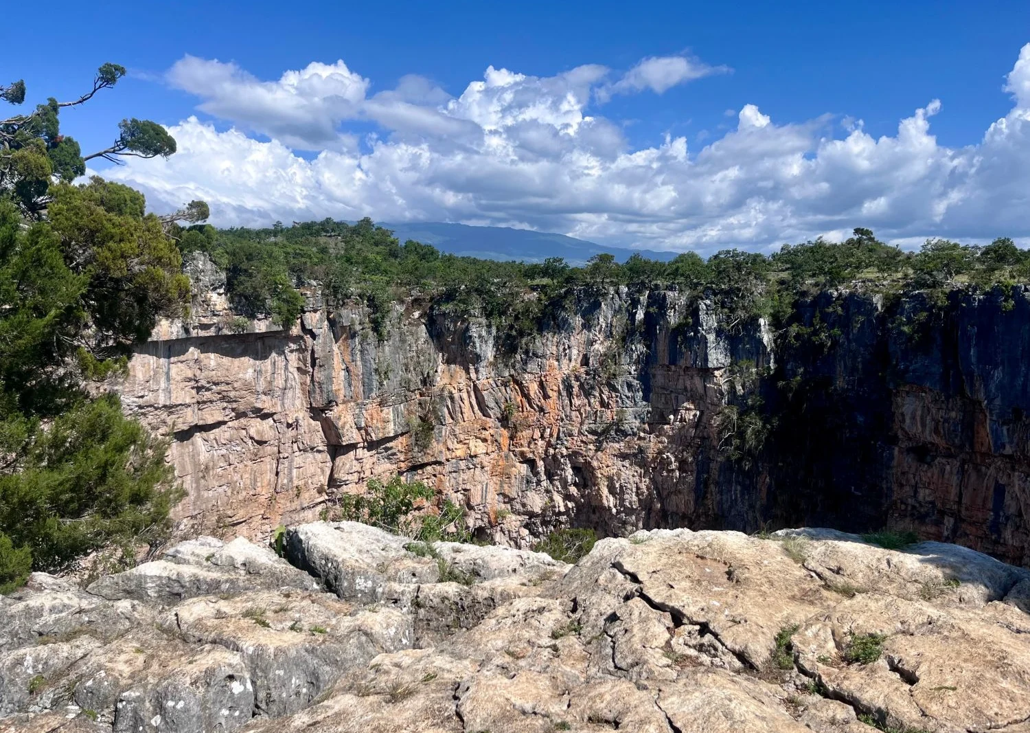
Hoyo Cimarrón is a geological formation in the village of Gracias a Dios, in the municipality of Nentón, Huehuetenango, a few kilometres from the Mexican border. Nentón is known for its natural sites, such as the Río Azul, the Río Lagartero and the Cenotes de Candelaria, and Cimarrón is without doubt one of the most striking.
According to the Sistema de Información Cultural of Guatemala’s Ministry of Culture and Sports, Hoyo Cimarrón is about 170 metres across and roughly 150 metres deep. The exact figures are not known, because no formal topographic survey of the site has been carried out yet. On its almost flat floor grows a dense forest, with trees around 30 metres tall.
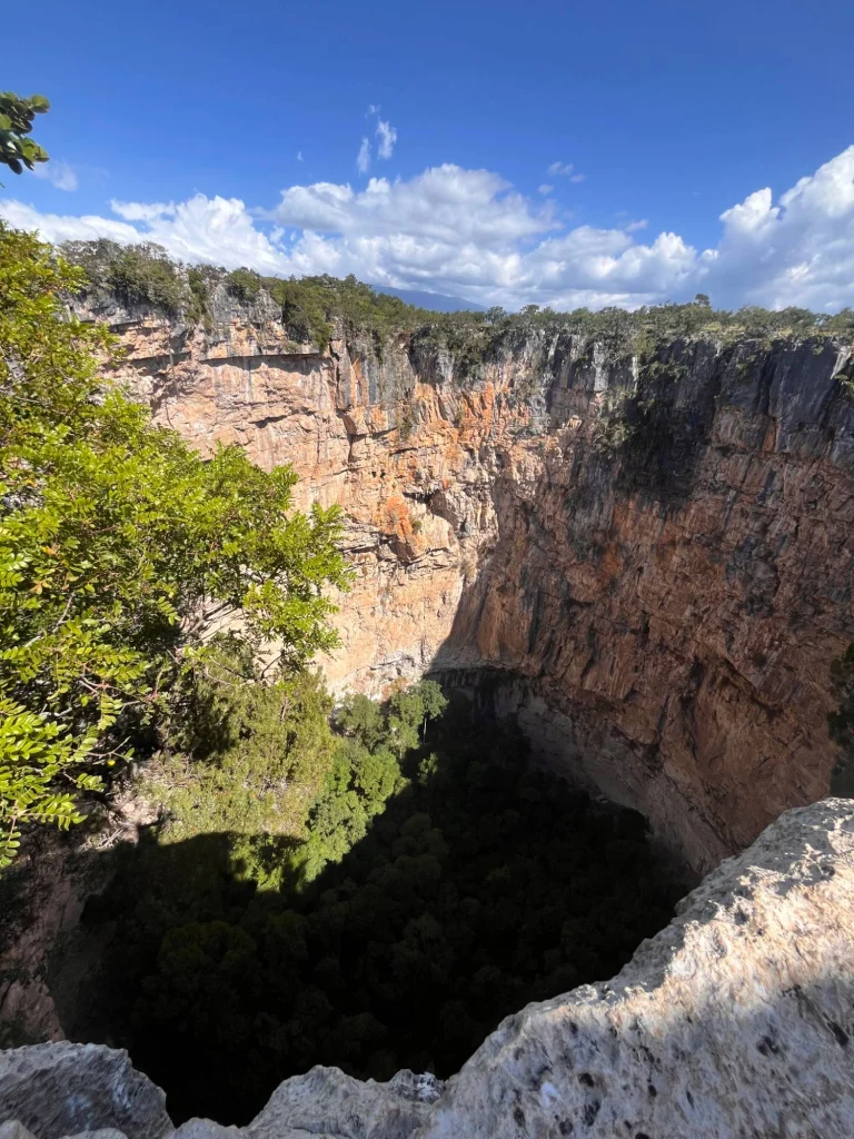
In scientific terms, Cimarrón is a karst doline, or sinkhole. Put simply, a doline is a depression in the ground that forms where the rock can be dissolved by water, especially rock such as limestone. Because of its size, more than 100 metres both wide and deep, and its nearly vertical walls, Cimarrón belongs to a special category of giant dolines that geologists call tiankeng, a Chinese term meaning “heavenly pit” (Ford & Williams, 2007; Duckeck, n.d.).
This region, known as the Depresión Cárstica de Nentón (the Nentón karst depression), is dotted with dolines, and Cimarrón is one of the largest (Ministerio de Agricultura, Ganadería y Alimentación [MAGA], 2001). In Guatemala these formations are also called siguanes, a word used for a ravine or a deep depression. Some neighbours also call it “El Socavón”, a word for a hole in the ground.
So why isn’t it called a cenote? Strictly speaking, a cenote is a doline that reaches the groundwater and therefore holds water, like the Cenotes de Candelaria in the same municipality. Cimarrón, by contrast, has a dry floor covered in forest.
What rock is it made of?
This is the key to understanding how this remarkable natural site formed. The rocks of the region are mainly limestones, a type of sedimentary rock. Unlike other sedimentary rocks, which form from sand or mud carried by rivers, limestone forms mostly in warm, shallow seas, from the build-up of shells, corals and the remains of tiny marine organisms, along with calcium carbonate that separates out of seawater.
Much of northern Guatemala, including the Sierra de los Cuchumatanes and its surroundings, is made of a thick sequence of limestones laid down during the Cretaceous period, known to geologists as the Ixcoy and Cobán formations (Walper, 1960). In other words, millions of years ago the place where Nentón now stands was the floor of a shallow sea. Over time, the movement of tectonic plates lifted those layers of rock into mountains and fractured them. Those cracks, together with abundant rain, created the perfect conditions for water to begin its work: dissolving the rock and shaping what we now know as the Nentón karst depression.
Did you know?
The rocks of the Nentón karst depression began to form during the Cretaceous, the period that runs from about 145 million to 66 million years ago. It is the period we learned about at school, when the continents that once made up Pangaea were still drifting apart and the Atlantic Ocean was growing wider.
Dinosaurs such as Tyrannosaurus rex and Triceratops lived at that time. Sea levels were also much higher than today, so much of what is now Guatemala lay under warm, shallow seas. That is where the limestone built up which, millions of years later, would give Cimarrón its shape.
The Cretaceous ended with the extinction of the dinosaurs (except birds, their direct descendants). Most scientists now agree that the main cause was the impact of an asteroid about 10 kilometres across, which struck what is now the Yucatán Peninsula, in Mexico, and left a crater some 180 kilometres wide known as Chicxulub (Schulte et al., 2010).
So how could Hoyo Cimarrón have formed?
As rainwater passes through the air and the soil, it absorbs carbon dioxide and becomes slightly acidic. When that water seeps into cracks in limestone, it dissolves the rock little by little, the way vinegar dissolves an eggshell, only far more slowly. Over thousands of years, the cracks widen into channels, caves and underground caverns (Ford & Williams, 2007).
If one of those cavities grows too large, the roof above it loses stability and at some point collapses. For a cavity to become that large, there is usually an underground stream that, as well as dissolving the rock, gradually carries away the material and blocks that break off; otherwise the hollow would fill up with its own debris. The result is a large depression with vertical walls and a floor covered in blocks of rock that, over time, fills with soil and vegetation. This kind of formation is called a collapse doline, and the same process explains many of the sinkholes that form in limestone areas such as Florida, in the United States (Miller, 1990; U.S. Geological Survey [USGS], 2018). The giant dolines of southern China, where the term tiankeng was coined, formed the same way, through the collapse of huge caverns carved out by underground rivers (Ford & Williams, 2007).
So how does this relate to Hoyo Cimarrón? We cannot say for certain yet. Its vertical walls, almost circular shape and the limestone around it are consistent with a collapse doline, but specific studies of Cimarrón are needed to know its history and age with certainty. Knowing, for example, whether there are cave entrances on its floor, whether Cimarrón and the other dolines in the area follow the direction of the fractures in the rock, or which way the region’s groundwater flows would help us better understand how it formed.
A hidden forest
To date, the inside of Cimarrón has not been formally studied, either biologically or speleologically (the study of caves). The first recorded descent took place only in 2015 (Duckeck, n.d.). Even so, some secondary sources and botanical collections made in Nentón suggest that the floor may hold Comitán junipers (Juniperus comitana, known locally as cedro or ciprés), oaks (Quercus sp.), pines (Pinus sp.), copal trees (Bursera sp.), guanacastes (Enterolobium cyclocarpum), nance (Byrsonima crassifolia) and even palms (Brahea sp.) (Medinilla Sánchez et al., 1996).
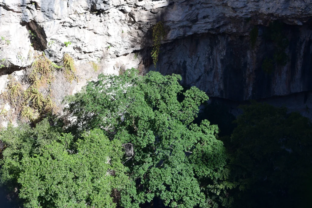
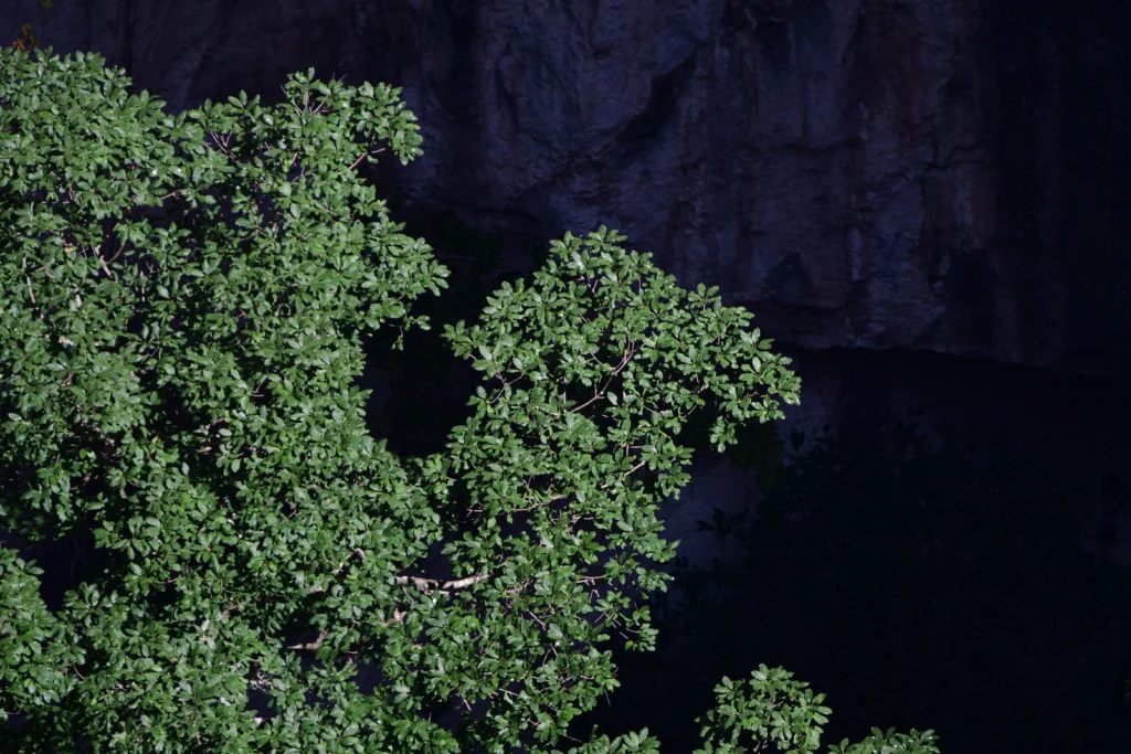
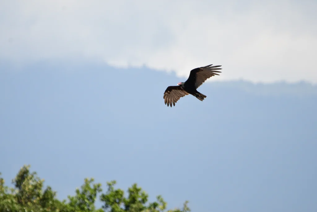
The Comitán juniper is a special case: it lives only in Guatemala and Chiapas, grows on limestone soils, and is listed as Endangered on the Red List of the International Union for Conservation of Nature, IUCN (Earle, n.d.). Animals reported in the surrounding area include deer, pacas, opossums, snakes, iguanas, lizards and a wide variety of birds (Ministerio de Cultura y Deportes, n.d.). Surrounded by walls more than 100 metres high, the floor of Cimarrón has conditions of shade and humidity different from those of the forest around it, so it may still hold surprises for science.
What oral tradition tells
Among those who know the area, it is said that Cimarrón may once have been a cenote that dried up, which over time allowed the forest we find inside it today to grow. There is also talk of underground rivers that disappeared, of a lost lagoon, and even of a landowner who, fleeing from thieves, threw himself into the hole with his treasure (Duckeck, n.d.).
No scientific evidence supports these stories, so they are considered part of oral tradition. But it is interesting to note that several of them revolve around water, and that is not so far from what geology tells us: in all likelihood, it was precisely the water flowing underground that carved out this great hole.
If you want to visit
Hoyo Cimarrón lies about 35 kilometres from the town of Nentón, between Finca La Trinidad and the village of Gracias a Dios, some 6 kilometres from the Mexican border. From the city of Huehuetenango, allow about four hours by road.
A 4×4 can drive all the way to Hoyo Cimarrón: from the spot where you leave the vehicle, it is only a few metres away. You can also walk in, about an hour and a half on foot. Entry costs Q25 per person (about $3.30), plus Q10 for parking (about $1.30). Prices noted in October 2026.
We recommend visiting with guides from the community, who know the path and the safe viewpoints; remember that its walls are vertical and it is best not to go near the edge. The climate is warm, so wear closed shoes and bring water and sun protection. And do not try to go down: a descent requires specialist equipment, experience in vertical techniques and the community’s permission. If you have time, you can make the most of the journey to see other sites in Nentón, such as the Cenotes de Candelaria.
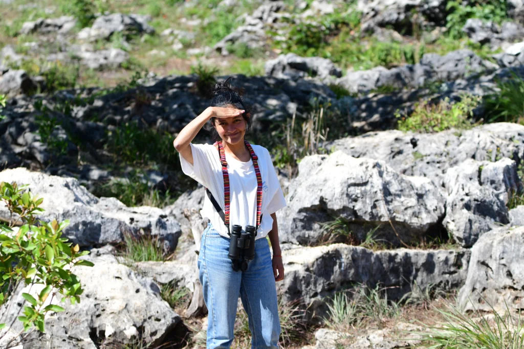
Hoyo Cimarrón is one of the stops on our trip to Huehuetenango.
Conclusion: a hole in the earth, a place in memory
Nentón is a land where several Maya peoples live side by side, among them the Chuj, Q’anjob’al, Akateko and Popti’, whose oral traditions have been strongly preserved, largely thanks to the relative remoteness of the region (Hopkins, 2020). However, as far as we could find, there is no documented record of rituals, offerings or archaeological finds related specifically to Hoyo Cimarrón. What we do have are the stories its neighbours tell: cenotes that dry up, waters that hide underground and treasure lost at the bottom. Like geology, these stories speak of water, of what lies hidden beneath our feet, and of the respect a place like this inspires.
So the next time you hear about Hoyo Cimarrón, remember that it is a formation that lets us see how water, rock and time can transform a landscape over millions of years, and a place that is part of the memory of those who live around it.
And even if we do not yet know the whole story of Cimarrón, perhaps that is precisely one of the reasons it is so fascinating.
References
- Duckeck, J. (n.d.). Hoyo El Cimarrón. Showcaves.com. https://www.showcaves.com/english/gt/karst/Cimarron.html
- Earle, C. J. (n.d.). Juniperus comitana. The Gymnosperm Database. https://www.conifers.org/cu/Juniperus_comitana.php
- Ford, D., & Williams, P. (2007). Karst hydrogeology and geomorphology. John Wiley & Sons.
- Hopkins, N. A. (2020). Chuj (Mayan) narratives: Folklore, history, and ethnography from northwestern Guatemala. University Press of Colorado. https://library.oapen.org/handle/20.500.12657/46847
- Medinilla Sánchez, O., Martínez Tuna, M., Vargas Ponce, J., España Esquivel, E., Romero Orellana, F., Ixcot, C., & Sánchez, M. (1996). Situación actual de la palma Brahea dulcis (HBK) Martius, en el municipio de Nentón, Huehuetenango [Technical report, 125 pp.]. Facultad de Agronomía, Universidad de San Carlos de Guatemala.
- Miller, J. A. (1990). Ground water atlas of the United States: Segment 6, Alabama, Florida, Georgia, and South Carolina (Hydrologic Atlas 730-G). U.S. Geological Survey. https://pubs.usgs.gov/ha/ha730/ch_g/G-text6.html
- Ministerio de Agricultura, Ganadería y Alimentación [MAGA]. (2001). Mapa fisiográfico-geomorfológico de la República de Guatemala, a escala 1:250,000: Memoria técnica (G. D. Alvarado Cabrera & I. R. Herrera Ibáñez, consultants). Unidad de Políticas e Información Estratégica (UPIE-MAGA) and Programa de Emergencia por Desastres Naturales (MAGA-BID). https://www.maga.gob.gt/download/fisiografia.pdf
- Ministerio de Cultura y Deportes. (n.d.). El Cimarrón. Sistema de Información Cultural (SICULTURA). https://www.sicultura.gob.gt/directory-directorio_c/listing/el-cimarron/
- Schulte, P., Alegret, L., Arenillas, I., et al. (2010). The Chicxulub asteroid impact and mass extinction at the Cretaceous-Paleogene boundary. Science, 327(5970), 1214–1218. https://doi.org/10.1126/science.1177265
- U.S. Geological Survey [USGS]. (2018). Sinkholes. Water Science School. https://www.usgs.gov/water-science-school/science/sinkholes
- Walper, J. L. (1960). Geology of Cobán-Purulhá area, Alta Verapaz, Guatemala. AAPG Bulletin, 44(8), 1273–1315.